Exercising & socialising your dog
Dogs are social animals by nature so it's important to walk your dog regularly to help your pooch socialise with people and other dogs. It's also a great way to relieve boredom - one of the most common reasons for dogs to misbehave.
Whenever you are out and about with your dog it's compulsory to:
- Have your dog on a leash (unless in a dog off-leash area)
- Use designated dog off-leash areas if you want to have your pet off lead
- Pick up their poop.
There are $834 on-the-spot fines for not adhering to these rules.
Dog prohibited areas
There are a few areas in Cairns where you can't take your pet, either on or off lead, unless it is a registered support animal.
- Public toilets
- Sporting fields
- Playgrounds (dogs must be 2m from a playground)
- Cemeteries
- Within beach stinger nets, or the area of beach directly in front of the stinger nets
- In the Lagoon and on the grassed areas next to the Lagoon
- Botanic Gardens precinct, including Flecker Gardens and Centenary Lakes
- Conservation areas, including the Red, Green, Blue and Yellow Arrow walking tracks; Cattana Wetlands; Crystal Cascades; The Rocks; and Babinda Boulders
Full details of dog prohibited areas can be found in our Designated Register - Prohibition of animals in public places ( PDF, 3.39 MB ).
Dog off-leash areas
There are 54 dog off-leash areas in Cairns, so there's bound to be one near you. Dog off-leash areas are clearly signed. If there's no signage, then you must have your pooch on a lead.
Most of our dog off-leash areas are shared spaces, meaning other people may also be using the area for recreation such as walking, jogging, riding bikes, playing ball games or using playgrounds and fitness equipment.
Please respect other users.
If your dog is not used to being around other people or animals, or can be spooked by loud noises and lots of activity, consider using a fenced off-leash area or only walking them on a lead.
You can find your nearest dog-off leash area using the interactive map and table below. Full details can also be found in our Designated Register - Dog off-leash areas ( PDF, 5.97 MB ).
Find out more about our off-leash areas, including if they are fenced, and the specific part of open spaces where you can have your dog off lead.
| Suburb | Address | Description | Fenced |
|---|---|---|---|
Aeroglen (fenced) | Aeroglen Drive, Aeroglen | Part of the southern end of Touch Park between the southern boundary of the sporting fields and the southern side of the park between Aeroglen Drive and the mangrove lined creek to the west. | Y |
Aeroglen | Greenbank Road, Aeroglen | Paterson Park on the northern side of Greenbank Road and the western side of Arnold Street. | N |
Babinda | Harwood Drive, Babinda | Northern part of Carl Mellick Park located at the western end of Harwood Drive. | N |
| Babinda | King Street, Babinda | Southern part of Bill Wakeman Park south of the internal access road south of the playing fields. | N |
Bayview Heights | Fairview Street, Bayview Heights | Part of Arthur Forno Park, at the western end near the Vista Street entrance to the park and behind houses in Vista Street, Fiesta Close and Flamenco Close. | N |
Bayview Heights | Corner of Anderson Road and Fairview Streets. | Ben Wilson Park and part of adjacent drainage reserve. | N |
Bentley Park | Robert Road, Bentley Park | Part of Robert Road Drainage Reserve, Robert Road, Bentley Park on the southern side of Robert Road adjacent to the creek. | N |
Bramston Beach | Bramston Beach Esplanade | The area of beach commencing 100 metres south of the stinger net and extending to the southern end of the beach. | N |
Bramston Beach | Bramston Beach Esplanade | The area of beach commencing at the northern end of the caravan park and extending northward. | N |
Brinsmead | Shale Street, Brinsmead | The area to the north of the central internal access in Goomboora park. | N |
Buchans Point | Beach Esplanade | From the rocks at the southern end of the beach to the first car park to the north. | N |
Bungalow (fenced) | 43-49 Scott Street, Bungalow | Part of Little Barlow Park | Y |
Caravonica (fenced) | Access via Lake Placid Road, Caravonica and Impey Street, Caravonica | The northern part of Barron Waters/Burrawungal Park, Lake Placid Road, Caravonica and the whole of Impey Reserve, on the eastern side of Impey Street located behind the houses fronting Impey Street. | Y |
Clifton Beach | Saxon Street, Clifton Beach | Part of parkland in Eddy Street, Clifton Beach between Eddy Street and the rear of houses in Escape Close for a distance of 50 metres from houses in Eddy Street and east towards Saxon Street. | N |
Clifton Beach | Upolo Esplanade | The area of beach from the northern end of Upolu Esplanade north towards Palm Cove and finishing 150 metres south of Veivers Road, Palm Cove. | N |
Clifton Beach | Upolo Esplanade | The southern end of Clifton Beach between the southern end of Arlington Esplanade and to the north of Kewarra Street, Kewarra Beach. | N |
Clifton Beach | Evergreen Road, Clifton Beach | Whole of Evergreen Park on the southern side of Evergreen Road and Western Side of Captain Cook Highway. | N |
Earlville (fenced) | De Jarlais St, Earlville | Part of Henley’s Hill Park covering the fenced dog exercise area to the west of De Jarlais St and to the south of the car park entry point off De Jarlais Street. | Y |
Edmonton | Accatino Close, Edmonton | McKinnon Creek Detention Basin at Isabella Estate. | N |
Edmonton | Trojan Street, Edmonton | Part of Carne Park, Trojan Street, Edmonton being on the eastern side of the Trojan Street entrance to the edge of the creek bed. | N |
Edmonton (fenced) | Wolff Street, Edmonton | Part of Fuller Park covering the south-western side of the park. | Y |
Ellis Beach | Beach Esplanade | From rocks at the southern end of the beach for a distance of 450 metres to the north (adjacent to the car park). | N |
| Gordonvale (fenced) | Fisher Road, Gordonvale | Fenced area to the south eastern side of Pyramid Parklands Gujura between the open drain and Fisher Road | Y |
Gordonvale | 19-23 Klarwein Close, Gordonvale | Part of Howard Bailey Park at the end of Klarwein Close being on the Western side of the Klarwein Street entrance and behind houses in Highleigh Road and bounded by the drain at the rear. | N |
Holloways Beach | Beach Esplanade | Beach at the northern end of Holloways Beach fronting Casuarina Street and north of Luke Street. | N |
Holloways Beach | Beach Esplanade | Southern end of Holloways Beach between Tamarind Street and Magnolia Street. | N |
Kanimbla | Tanganelli, Yellowfin and Sweetlip Close, Kanimbla. | Part of Robson St Drainage Reserve, Kanimbla on the southern side of Hymes Street, Yellowfin Close and Sweetlip Close behind the dwellings, the northern side of Tanganelli Close behind the dwellings and west of the cane rail line. | N |
Kewarra Beach | Beach Esplanade | The area of beach commencing 100 metres south of the stinger net and continuing to the rocks at Taylor Point. | N |
Kewarra Beach (fenced) | Nova Street, Kewarra Beach | Part of Nova Street Park and Sunbird Park, Kewarra Beach on the southern side of Nova Street and the northern side of Nova Street Drain, between the two pedestrian pathways that bisect the park. | Y |
Machans Beach | Beach Esplanade | Southern end of Machans Beach south of Cinderella Street to the Barron River. | N |
Manunda | 1-11 English Street, Manunda | Part of Harald Falge Park being the area between McCormack Street and drain. | F |
Manunda (fenced) | 17 Kiernan Street, Manunda | Parkland situated in Card Avenue, Manunda between houses in Card Avenue and behind houses in Barlow Street | Y |
Mooroobool | 2 Carnation Drive, Mooroobool | Irene Street Flood Plain B – North of Langan Street, east of Irene Street, west of Carnation Drive and south of Marigold Close. | N |
Mt Sheridan | Melia Close, Mount Sheridan | Sawpit Gully Detention Basin at Forest Gardens. | N |
Mt Sheridan | 9-35 Trafalgar Road, Mt Sheridan | Trafalgar Detention Basin and Balmoral Close Park from the south of Trafalgar Road to the creek to the south and from Idalia Road to the property boundary to the west. | N |
Mt Sheridan | George Cannon Drive, Mt Sheridan | Detention basin in George Cannon Drive Park south and east of Forest Gardens Boulevard, north of George Cannon Drive and west of Des Chalmers Drive. | N |
North Cairns | 320-354 Lake Street, Cairns North | Parkland at the northern end of the Esplanade between Smith and Lily Streets and bounded by the mangroves to the east and the Esplanade to the west. | N |
Palm Cove | Beach Esplanade | The area of beach between the Palm Cove jetty and the rocks on the northern side. | N |
Palm Cove (fenced) | Osterland Street, Palm Cove | Part of Silver Crescent Park, Palm Cove located to the east of the pedestrian pathway and to the northeast of Osterland Crescent. | Y |
Redlynch (fenced) | Gamburra Drive, Redlynch | Part of Gamburra Drive Park, located on the northern side of Huntley Crescent and the western side of Gamburra Drive, Redlynch east of the BMX jumps and the creek. | Y |
Redlynch | 184-190 Harvey Road, Redlynch | Portion of Redlynch Village Green off Harvey Road, Redlynch being at the railway line end of the parkland and behind houses in Ficus Close. | N |
Smithfield (fenced) | Survey Street, Smithfield | Part of Rainy Mountain Park in Cumberland Avenue covering the northern end of the park behind houses in Survey Street and the fenced dog exercise area. | Y |
| Smithfield (fenced) | Village Drive, Smithfield | Fenced area to the east of Bamford Close and north of McGregor Road | Y |
| Stratford | Alamein Street, Stratford | Southern part of Jalarra Park south of Wilunga Street to the edge of the treeline | N |
Trinity Beach | Beach Esplanade | The beach from the northern end of Vasey Esplanade north to the rocks. | N |
Trinity Beach | Beach Esplanade | The beach at the southern end of Trinity Beach to the south of Peacock Street. | N |
Trinity Park | Beach Esplanade | Half Moon Bay beach, Trinity Park to the south of the car park entrance. | N |
| White Rock | Hollywood Boulevard, White Rock | Eastern side of Minniecon / Munci Gunji Park, east of the dwellings fronting Hollywood Boulevard | N |
White Rock (fenced) | Mercurio Street, White Rock | Part of Mercurio Street Park, White Rock, located on the western side of Mercurio Street and directly south of the stormwater drain. | Y |
Whitfield | 19-63 McManus Street, Whitfield | Engineers Park on the corner of Bott and McManus Streets, Whitfield behind houses in Bott Street, Prescott Street and Neeve Close. | N |
Whitfield | 181-217 McManus Street, Whitfield | Bunny Jarrett Park on the northern side of the drainage easement and creek at the corner of McManus and Bolton Streets, Whitfield and behind houses in McManus Street and Murchison Street | N |
Whitfield | 237C McManus Street Whitfield | Colin Penridge Park located to the north of Murchison Street and west of McManus Street and Hillview Crescent. | N |
Woree | 28-32 Anderson Road Woree | Port of Hussey Park off Loretta Close, Woree being the eastern end of the park adjacent to Loretta Street and behind houses in Karen Close and Carmel Close. | N |
Yorkeys Knob | Beach Esplanade | The southern end of Yorkeys Knob beach south of the corner of Sims Esplanade and Kempton Street. | N |
Last Updated: 13 November 2025
Latest News > All News
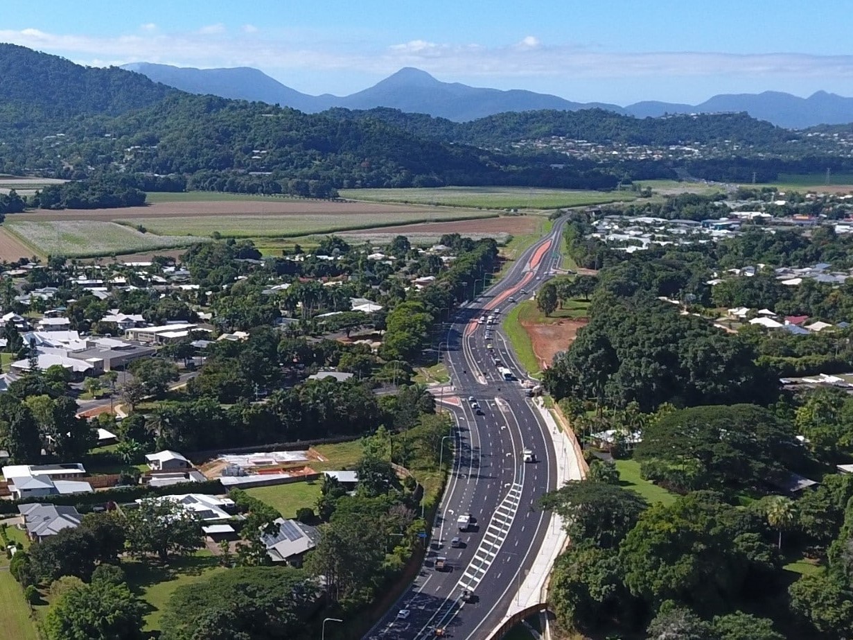
Council highlights advocacy wins
Hundreds of millions of dollars for housing, water security and major infrastructure are among the significant advocacy outcomes secured for...
31 July 2026
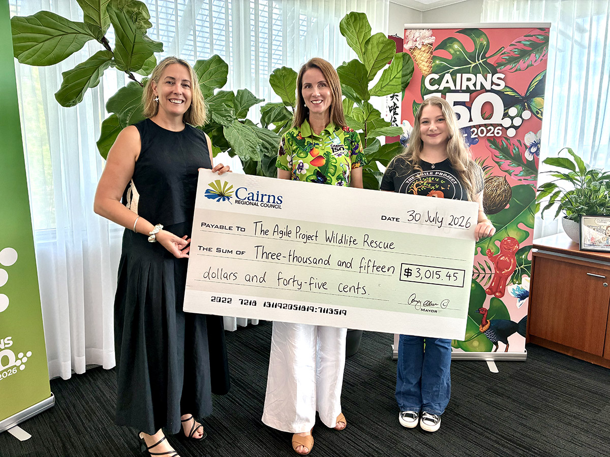
Community donations help more than 100 joeys
More than $3,000 raised through Council's Free Green Waste campaign will help The Agile Project continue its work rescuing, rehabilitating...
31 July 2026
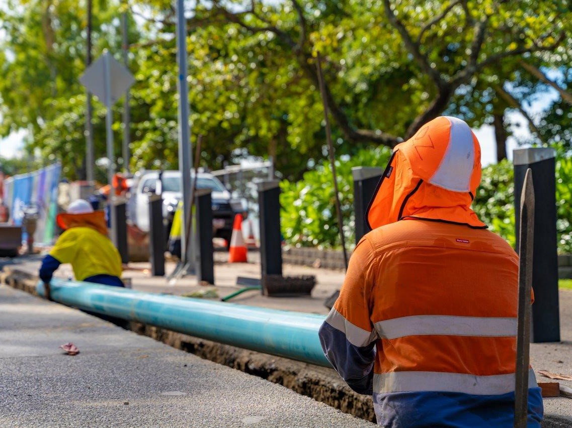
Council invests $8.9M in wastewater upgrades
Reliable wastewater infrastructure is essential for public health, environmental protection and the continued delivery of services to the Cairns community....
30 July 2026